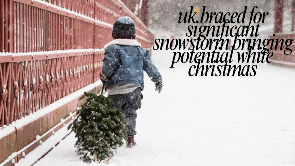
Britain is bracing for a potentially significant snowstorm as Arctic air pushes south, bringing the possibility of heavy snow, icy conditions, and travel disruption across parts of the UK. Forecasters warn that this cold snap could coincide with the festive period, sparking renewed hope for a “white Christmas.” According to the Met Office, a white Christmas requires at least one snowflake to be observed on 25 December, meaning even a dusting in the hills qualifies.
Predicting snow on Christmas Day is notoriously tricky because small changes in storm tracks or air patterns can dramatically affect snowfall distribution. This article explores the latest forecasts, the regions most likely to see snow, potential impacts on travel and services, practical steps households can take to prepare, and what to expect if the UK experiences a snowy Christmas. It is designed to provide clear, evidence-backed guidance for families, commuters, and local authorities preparing for winter weather.
What meteorologists are seeing now
Meteorologists monitor several key factors when predicting snow: the position of the jet stream, incoming air masses, and local surface conditions. Current models show a strong cold front moving south from Arctic regions, interacting with moist Atlantic air. This combination can produce snow, sleet, or freezing rain, particularly in northern and elevated areas. Authorities are ready to issue warnings if significant accumulations are expected. The precise snowfall on Christmas Day will only become clearer as the date approaches, but current patterns suggest at least a heightened risk in certain regions.
Why long-range forecasts are cautious
While long-range forecasts can indicate favorable conditions for snow, the Met Office only provides high-confidence predictions up to about five days in advance. Minor shifts in air pressure, storm tracks, or wind direction can completely change which areas receive snow and which see rain. For this reason, people should prepare for possible disruption but not assume a white Christmas until the week leading up to 25 December.
How the Met Office defines “white Christmas”
The Met Office’s definition of a white Christmas is simple but often misunderstood: at least one snowflake must fall at any UK weather station on 25 December. Widespread or settled snow is not required. This definition maintains consistency in climate records but can create a mismatch between what people experience on the ground and the official label.
Regions most likely to see snow
Historical data and model guidance highlight areas most at risk:
- Scotland and the Northern Highlands: Highest likelihood of snow and hill accumulations.
- Northern England and upland Wales: Elevated risk in exposed inland areas.
- The Pennines and Peak District: Likely to see sleet or snow showers.
Lowland and southern regions are generally less likely to experience sustained snow unless a particularly strong cold front coincides with heavy coastal precipitation. Cities such as Edinburgh and Newcastle often have higher probabilities for flakes, but these are not guaranteed.
Likely impacts: travel, power, and services
Even moderate snow can disrupt daily life in the UK because the transport system is primarily designed for rain:
- Roads: Motorways and rural routes may see closures or long tailbacks.
- Railways: Points freezing and trackside issues can cause delays or cancellations.
- Airports: De-icing and low visibility may lead to flight disruption.
- Power supply: Heavy, wet snow can damage power lines, causing local outages.
- Supply chains: Food and fuel deliveries may be slowed if roads become impassable.
Communities are advised to monitor local alerts and prepare for 24–72 hours of potential disruption.
Preparation checklist for households
Practical preparation can minimize risk and stress:
- Emergency supplies: Stock water, non-perishable food, torch, batteries, blankets, first aid kit, essential medications.
- Heating and pipes: Service your heating system, insulate exposed pipes, and know how to turn off water in case of bursts.
- Fuel: Ensure vehicles and heating fuel are topped up.
- Grit and footwear: Keep rock salt or grit handy; wear insulated, non-slip shoes outdoors.
- Power preparedness: Have backup phone chargers or a generator if safe to use.
- Pets and livestock: Make sure animals have shelter, food, and unfrozen water.
- Support for vulnerable people: Check in with elderly or at-risk neighbours and ensure they have an emergency plan.
Tips for drivers and commuters
- Avoid non-essential travel during warnings.
- If driving is necessary: carry a shovel, warm clothing, food, and a charged phone; reduce speed and allow extra braking distance.
- Public transport: Check operators’ updates; delays and cancellations are common during snow events. Rural roads may not be treated immediately.
Advice for businesses and local authorities
Businesses should:
- Prepare contingency plans, including remote working and delayed deliveries.
- Communicate with staff about travel risks.
Local authorities should:
- Ensure gritters and emergency teams are ready.
- Maintain registers of vulnerable residents and provide warming centers if needed.
Climate context: why white Christmases are less predictable
While climate change increases average temperatures, it does not eliminate snow. Some Arctic cold snaps can still bring heavy snow, especially to northern and upland regions. Warmer air can carry more moisture, sometimes producing intense snow where cold pockets exist. This means that even though widespread snow is less common, sharp cold spells and localized snowfall remain possible.
How forecasters will update the public
- Watch official Met Office briefings and local authority alerts in the five days leading up to Christmas.
- Follow transport operators for real-time disruption updates.
- Use official sources for accurate information; social media may amplify unverified reports.
Community response if snow arrives
If snow falls, communities often respond quickly:
- Neighbours help with clearing paths and checking on vulnerable residents.
- Local volunteer groups assist with food or medicine deliveries.
- Staying calm, avoiding unnecessary travel, and following guidance keeps everyone safer while allowing people to enjoy the festive snow safely.
xiangaijiaqi.com: What It Is, How It Works, and How to Use It Safely
Conclusion
A white Christmas remains possible for parts of the UK if the Arctic cold front combines with moist Atlantic air, but certainty is limited until the week before 25 December. The Met Office’s definition of a white Christmas requires only a single snowflake, which may not reflect local conditions. Households, commuters, and businesses should use the coming days to prepare: stock essentials, check heating and pipes, and ensure vulnerable people have support plans.
Travel may be disrupted, and local authorities will focus on maintaining safety and essential services. Climate change reduces the likelihood of widespread, lowland snow but does not prevent cold spells and localized snowfall. By following official forecasts, preparing practical measures, and staying aware of changing conditions, the UK can manage risks and enjoy the festive season even if snow arrives unexpectedly. Responsible preparation is the key to a safe and enjoyable winter.
FAQs
1. How likely is a white Christmas in the UK this year?
Current patterns suggest elevated risk in northern and upland areas, but forecasts are only reliable five days in advance.
2. How does the Met Office define a white Christmas?
At least one snowflake observed at any UK weather station on 25 December qualifies as a white Christmas.
3. What should I store at home in case of a snowstorm?
Water, non-perishable food, torch, batteries, blankets, first aid kit, essential medicines, fuel for vehicles or heating.
4. Will public transport run during heavy snow?
Services may be reduced, delayed, or cancelled; only travel if essential, and monitor operator updates.
5. How can I help vulnerable neighbours during a cold snap?
Check they have food, medications, and heating, offer assistance with essentials, and maintain regular contact.